Querying Spatial Features with pg_featureserv
Martin Davis
4 min readMore by this author
In addition to viewing PostGIS spatial data as vector tiles using pg_tileserv, it is often necessary to access data features directly. This supports use cases such as:
- display features at a point or in an area of interest
- query features using spatial and/or attribute filters
- retrieve features for use in a web application (for tabular or map display)
- download spatial data for use in applications
For the past twenty years this need has been met by the venerable OCG Web Feature Service (WFS) specification. Recently this standard has been updated to reflect modern best practices for web data access and spatial data on the web. The new OGC API for Features standard now provides a RESTful API , JSON and GeoJSON as the primary data formats, hypermedia-friendly linked data, and OpenAPI support.
This new specification is a perfect fit for the microservice architecture of Crunchy Spatial.
It has the benefit of being easily extensible, which allows us to expose more of the rich spatial capabilities of PostGIS. This is the genesis of the pg_featureserv service for publishing PostGIS data on the web.
.png)
pg_featureserv has the following features:
- Written in Go to allow simple deployment of binaries, with no complex dependency chains. Also, Go provides a very effective platform for building services with low development effort and risk of defects.
- Ready-to-run configuration defaults, so that basic deployment just requires setting a database configuration string and running the program.
- Automatic publishing of database spatial tables, views and functions, using the database catalog to provide metadata.
- Support for most of the OGC Features API, including
limitandoffsetpaging,bboxfiltering, andpropertiesresponse shaping. - Additional parameters to expose the power of PostGIS, including
orderByandtransform. - Function-based data sources allow generating feature datasets using complex query logic.
- A web user interface to explore published feature collections and view feature data on maps.
Best of all, pg_featureserv is easy to use! Here's how to try it out. (Most of the steps just involve getting some spatial data in a PostGIS database. If you already have a database, just skip to step 3 and input your own database connection information).
Make a database, and enable PostGIS.
createdb postgisftw
psql -d postgisftw -c 'create extension postgis'
Download some spatial data and load it into PostGIS.
curl -o https://www.naturalearthdata.com/http//www.naturalearthdata.com/download/50m/cultural/ne_50m_admin_0_countries.zip unzip ne_50m_admin_0_countries.zip shp2pgsql -S 4326 -D -I ne_50m_admin_0_countries | psql -d postgisftwDownload and unzip the
pg_featureservbinary for your platform. (Linux, Windows, MacOS )Set the
DATABASE_URLenvironment variable to point to your database, and start the service.export DATABASE_URL=postgresql://postgres@localhost:5432/postgisftw ./pg_featureservPoint your browser to the service web interface.
Explore the data!
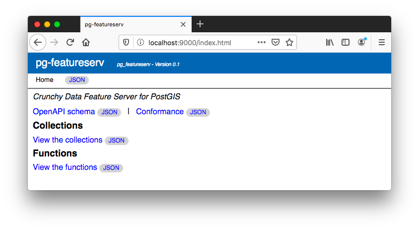
The service provides a JSON-based API for programmatic service discovery and data access following the OGC API - Features standard. The JSON API landing page is:
The feature collections can be listed using:
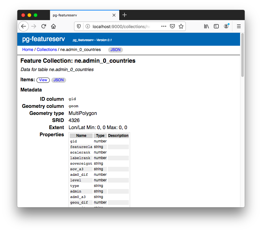
The metadata for the Natural Earth countries table is at:
A basic query for country features is:
A more realistic query example is to retrieve the names of the 20 most populous countries:
The API for functions is similar, but uses the path functions.
The items query for functions accepts query parameters which specify the function arguments:
A human-viewable web user interface is also provided, allowing easy browsing of feature collections and data. The top-level page is at:
The user interface allows listing the feature collections and functions published by the service. The metadata for each collection and function can be displayed.
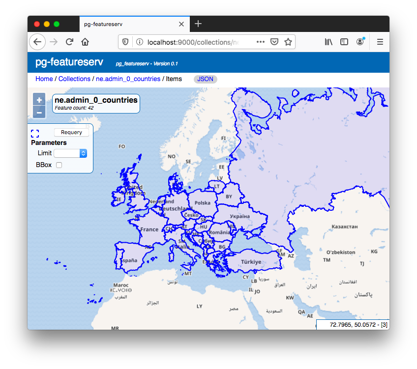
 A web map interface allows you to view the results of queries for features. It provides some simple controls to allow setting query parameters and function arguments.
 The
The pg_featureserv service provides an easy-to-use, easy-to-deploy web API for publishing spatial data from PostGIS. It's highly functional as it stands, and in the future we hope to enhance it to provide even more access to the rich spatial functionality of PostGIS. Try it out and let us know what you think!
Related Articles
- British Columbia, Time Zones, and Postgres
6 min read
- Postgres Serials Should be BIGINT (and How to Migrate)
11 min read
- Postgres 18 New Default for Data Checksums and How to Deal with Upgrades
4 min read
- PostGIS Performance: Simplification
3 min read
- How to Read Postgres EXPLAIN: A Guide to Scan Types
9 min read